DETAILS
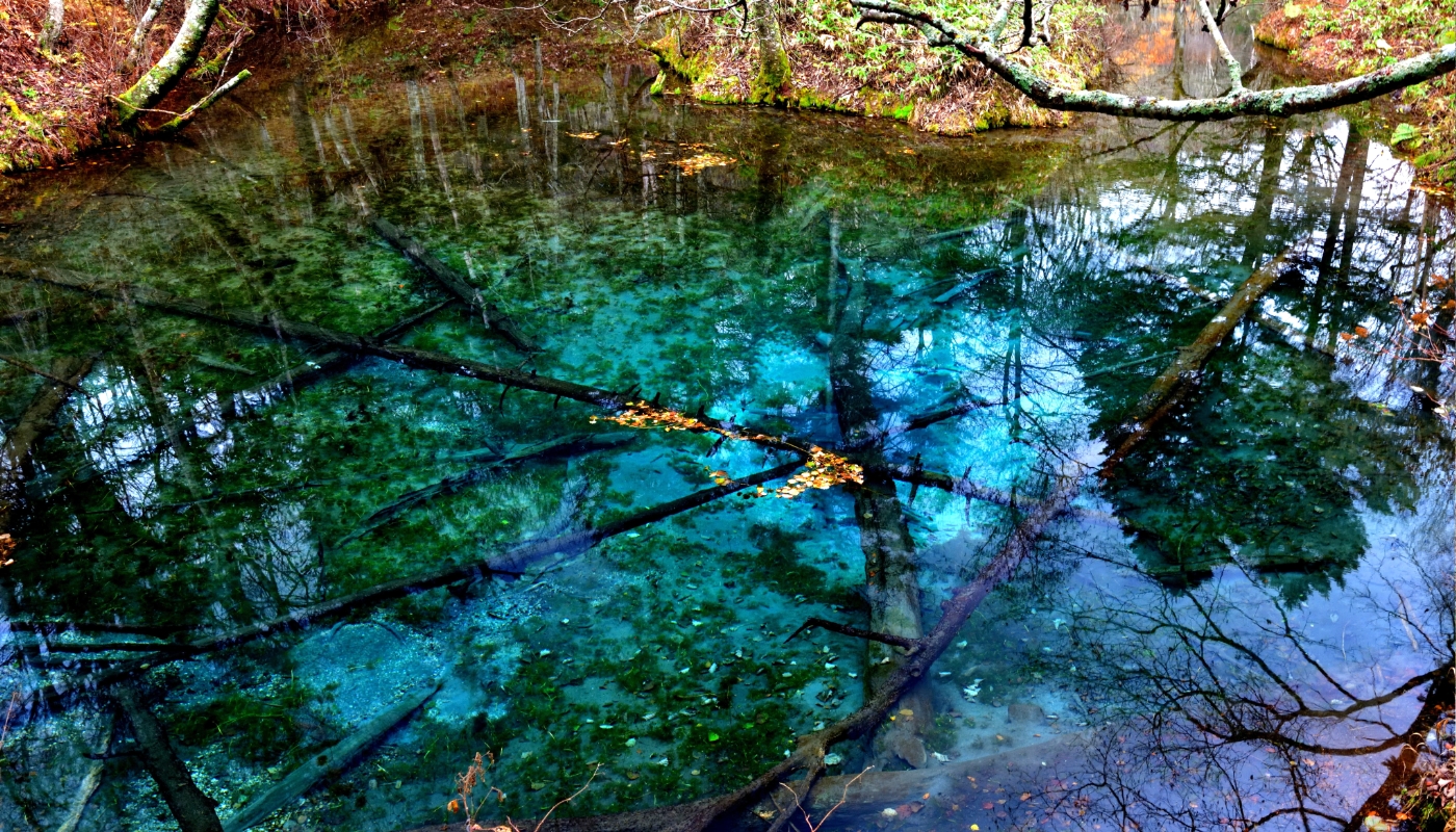
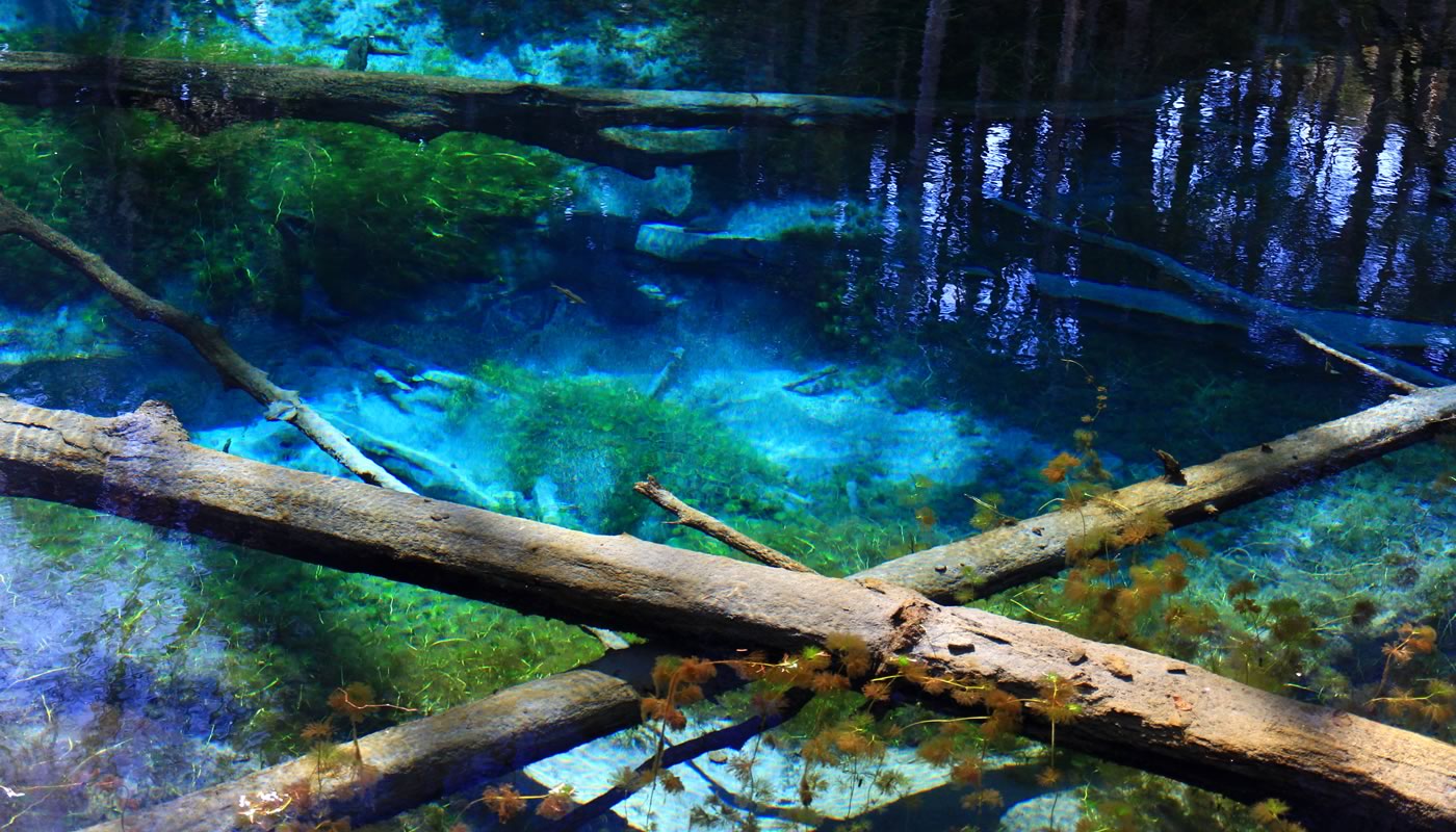
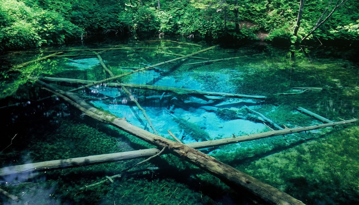
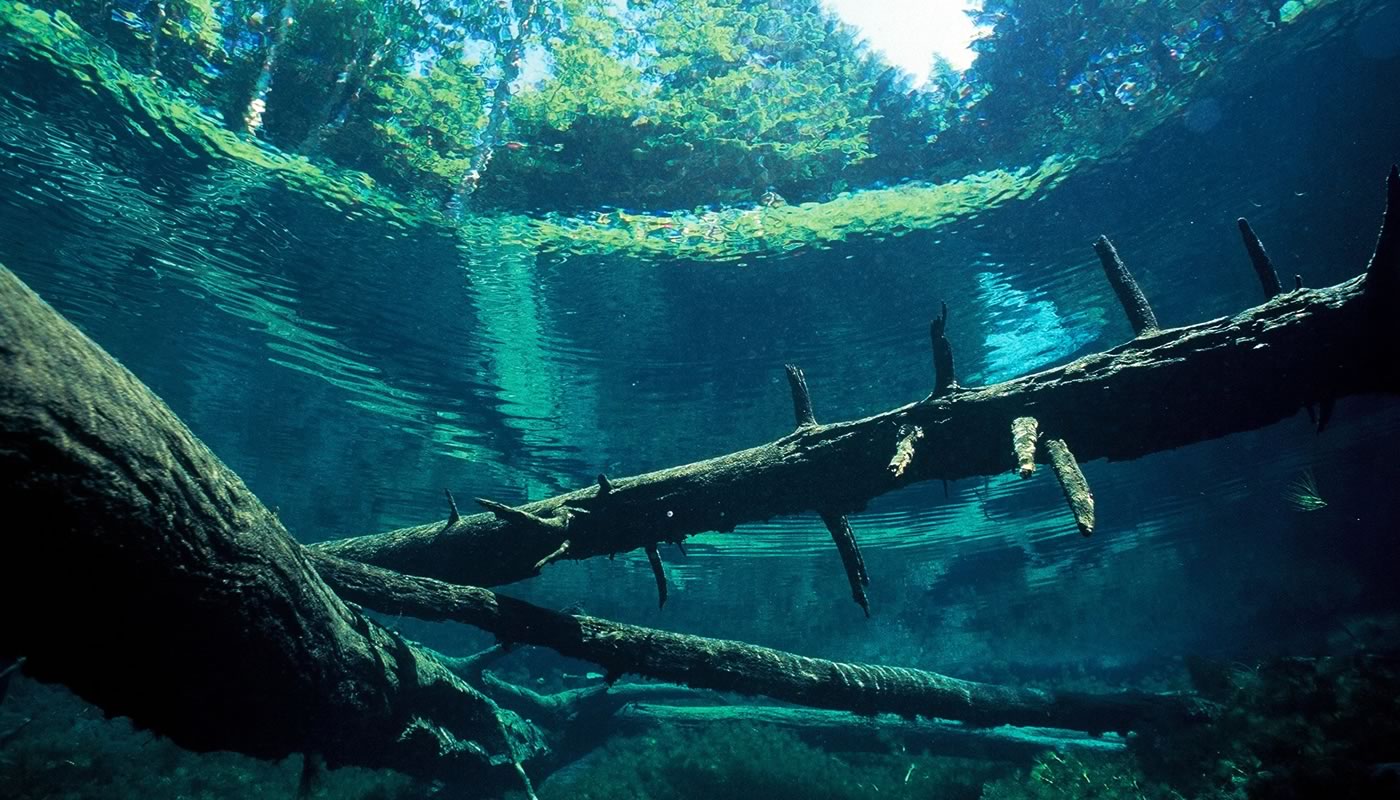
This pond locates deep in the mountain where the groundwater from Lake Mashuko springs out. Kaminokoike (child of the gods) Pond got its name from stories that it is fed by underground waters from Lake Mashuko, which is known as Kamuito (Lake of the Gods) by the Ainu people.
Lake Mashuko differs greatly from other lakes because there is no river flowing into it or out. Yet, the water level of the lake doesn't change even when tons of snowmelt water flows into it in the spring. It's because the lake lets the underflow water spring out to the ponds around it. About 12,000 tons of the underwater has been gushing in Kaminokoike Pond every day. You can see clearly to the bottom of the pond as it is a small pond of 220m in circumference and 5m in depth and of the very clear water.
The water stays at low 8℃ throughout the year, which keeps the submerged trees from rotting in the blue water. Red-spotted Dolly Varden trout add to the indescribable beauty as they swim amongst the petrified-looking debris.
ACCESS
NOTES
- Drive into the forest road from Dodo (Hokkaido Prefectural Route) 1115 to Kaminokoike Pond. The parking lot (0 JPY) is unpaved.
- There are 2 Japanese style vault toilets.
- Snow is not removed during winter. Drive carefully as snow may remain until May.
- Kaminokoike Pond Kanjiki (snowshoe) Walking Tour is held in February every year.
